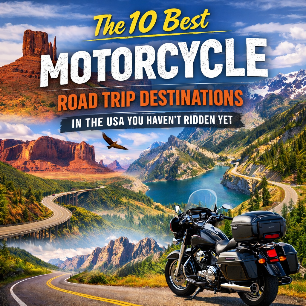
TL;DR
Key Takeaway: The most-hyped motorcycle roads in the USA — Tail of the Dragon, Pacific Coast Highway — are overcrowded, over-policed, and increasingly hostile to riders. The real gems are in the overlooked middle: remote desert canyons, high-altitude forest loops, and coastal backroads that don’t show up in mainstream “best motorcycle roads” lists.
Best by Scenario:
- Solo adventure rider seeking solitude: Loneliest Road in America (US-50, Nevada)
- Sport bike + technical curves: Beartooth Highway, Montana/Wyoming
- Cruiser + scenery + manageable mileage: Natchez Trace Parkway, Mississippi/Tennessee
- Year-round riding: Southern Utah’s Canyon Country loop
Counterintuitive Insight: The most photogenic motorcycle roads in America are often the worst to actually ride. Chase the pavement quality and traffic density first — the scenery will follow.
You’ve Seen the Same List a Hundred Times. Here’s Why That’s a Problem.
You type “best motorcycle road trip USA” into Google, and within seconds you’re looking at the same rotation of destinations you’ve seen since 2009. Tail of the Dragon. Blue Ridge Parkway. Highway 1. Route 66.
And look — those are real roads. Some of them are genuinely great. But if you’ve been riding for more than a few years, you already know what happens when you show up: tourist traffic, speed traps every few miles, RVs hugging the center line, and more GoPro-mounted sport bikes than you can count. The experience rarely matches the myth.
I’ve put close to 120,000 miles on various bikes over the past decade, ranging from a beat-up KLR 650 to a Street Glide to a Ducati Multistrada. I’ve ridden the greatest hits. I’ve also spent a lot of time finding what’s off the beaten path — and what I’ve found is that the best motorcycle road trips in the USA aren’t the ones with the best marketing. They’re the ones with the best pavement, lowest traffic, and most honest sense of place.
This list is built on that experience. It’s not a ranking of the most famous roads. It’s a guide to the roads that will actually make you a better rider and give you a better story.
My Evaluation Framework
Before we get into the destinations, here’s exactly how I evaluated each one. Too many “best motorcycle roads” lists are written by people who drove a car through once, or who are regurgitating older lists. That’s how you end up recommending roads that have been closed, repaved into oblivion, or turned into law enforcement revenue generators.
What I weighted heavily:
- Pavement condition — not just whether it’s paved, but whether it’s been maintained consistently. Some mountain roads have stunning views and frost-heave damage every 30 feet.
- Traffic density by season — a great road in April can be a parking lot in July. I note the best windows for each destination.
- Enforcement climate — some corridors exist specifically to ticket motorcycles. I’ve learned to factor that in.
- Practical infrastructure — fuel, food, and lodging gaps. A 200-mile stretch with one gas station matters if you’re on a 4-gallon tank.
- Riding variety — a road that’s just sweepers for 300 miles gets boring. The best trips mix curves, straights, elevation change, and surface types.
What I excluded:
Any road that appears in the top 5 results for “best motorcycle road USA” was disqualified unless it had a specific underrated variant worth highlighting. I also excluded roads with active construction projects that have made riding genuinely unpleasant (sorry, parts of US-89 in Arizona right now).
The mistake most lists make: They optimize for photography, not riding. A road with a dramatic mountain backdrop and a terrible chip-seal surface is going to look great in a thumbnail and feel awful under your tires.
1. US-50 — The Loneliest Road in America (Nevada)
Why Most Riders Skip It — And Why That’s Their Loss
US-50 across Nevada has exactly one thing going against it as a motorcycle destination: it’s not dramatic in the way Instagram demands. There are no tight switchbacks. The road doesn’t hug cliff faces. It just… goes. For about 410 miles, it crosses basin after basin, rises over mountain ranges, drops into ghost towns, and gives you the kind of riding where your mind actually goes quiet.
That’s exactly what makes it exceptional.
I rode this solo in late September, camping at Berlin-Ichthyosaur State Park midway through. The pavement on US-50 is consistently better than you’d expect for a low-traffic federal highway. The sightlines are long, so you can ride at a pace that feels good without constantly braking for blind curves. And because it’s not on anyone’s bucket list, you will genuinely go hours between seeing another motorcycle.
Real-world constraint: There are significant fuel gaps. Austin, Nevada (the midpoint town) has one gas station. Carry extra fuel or map your fill-ups aggressively. I run a 6.6-gallon tank and still paid close attention.
Best for: Riders who want mental decompression, adventure tourers, anyone who’s tired of riding in a pack.
Avoid if: You need constant stimulation, you’re on a bike with under 150-mile range, or you’re riding in summer — temperatures through the valleys regularly hit 105°F+.
Best window: Late April through early June, or September through October.
2. Beartooth Highway (US-212) — Montana and Wyoming
The Most Technical Scenic Road You Can Ride Without a Passport
You may have heard of Beartooth. It occasionally cracks top-ten lists. But most riders who mention it have either not ridden it or ridden it at the wrong time of year — and the difference between a good Beartooth trip and a miserable one comes down entirely to timing and preparation.
The highway climbs to 10,947 feet. That matters for two reasons: it closes from mid-October to late May (sometimes later), and when it’s open, afternoon thunderstorms are almost guaranteed in July and August. I got caught in hail near the summit in early August. I was wearing summer mesh. It was a learning experience.
The actual riding is world-class. The switchbacks approaching the plateau from Red Lodge are tight, well-surfaced, and surrounded by scenery that doesn’t look real. The plateau itself is high-alpine tundra — you’ll be above treeline for miles, riding across what feels like the surface of another planet.
What separates Beartooth from the Blue Ridge: The curves here require actual skill. You can’t drift through them on autopilot. The elevation changes also affect your bike’s performance — fuel-injected bikes handle it fine, but older carbureted machines may run rich at altitude.
Pros:
- Extraordinary surface quality on the main highway
- Low traffic on weekdays outside peak season
- Combined with Chief Joseph Scenic Highway (WY-296), you get a 100-mile loop that’s among the best in North America
Cons:
- Weather window is narrow (June through early September)
- No fuel on the plateau — fill up in Red Lodge or Cooke City before ascending
- The tourist traffic in peak season (July 4th week especially) can be frustrating near the summit pullouts
Best for: Experienced riders on capable bikes. Not recommended for brand-new riders or bikes without modern ABS on the switchbacks.
3. Natchez Trace Parkway — Mississippi, Alabama, Tennessee
The Underrated Answer to the Blue Ridge Parkway Crowd
Everyone talks about the Blue Ridge Parkway. Nobody talks about the Natchez Trace. This is a mistake.
The Trace runs 444 miles from Natchez, Mississippi to Nashville, Tennessee. It’s a National Parkway — no commercial traffic, no trucks, 50 mph limit — and it’s lined with ancient mounds, Civil War sites, cypress swamps, and hardwood forests that turn extraordinary colors in October and November.
The riding itself is smooth and forgiving. The curves are long and sweeping rather than technical. This makes the Trace ideal for cruisers, touring bikes, and riders who want to cover ground without constantly scrubbing speed. I’ve ridden it on a Heritage Softail and it felt like the road was built specifically for that bike.
What most riders miss: The Trace is nearly always cold or cool in the morning, even in summer. Start early, carry layers, and stop at the Pharr Mounds (milepost 286.7) — they’re 2,000-year-old Native American burial mounds and almost nobody stops there despite being right on the road.
Comparison to Blue Ridge Parkway:
| Feature | Natchez Trace | Blue Ridge Parkway |
|---|---|---|
| Length | 444 miles | 469 miles |
| Traffic density | Low year-round | High May–Oct |
| Curves | Sweeping, easy | More technical |
| Elevation | Low (max ~600 ft) | High (max 6,047 ft) |
| Best season | Oct–Nov, March–April | May–June, Sept |
| Fuel access | Limited (exits every ~30 mi) | Better access |
| Commercial vehicles | None allowed | None allowed |
Best for: Cruiser riders, touring couples, anyone who wants history and culture alongside the riding.
Avoid if: You’re chasing technical corners or high-altitude scenery.
4. Colorado’s West Elk Loop — The San Juan Mountains Variant
Colorado Has Better Roads Than the Ones Everyone Rides
Most Colorado motorcycle content focuses on Trail Ridge Road (Rocky Mountain National Park) or Independence Pass. Both are great. Both are also jammed in summer.
The West Elk Loop — a 200-mile circuit through Gunnison, Crested Butte, Paonia, and Delta — is almost entirely overlooked. It combines Black Canyon of the Gunnison (one of the most dramatic geological formations in North America, full stop), high-altitude aspen forests, and the long descent into the North Fork Valley wine country.
Colorado Highway 92 along the north rim of Black Canyon is the section that will stay with you. The road runs right along the canyon edge in places. The pavement is decent, the curves are intermediate-level, and the views into the 2,700-foot deep canyon are genuinely vertiginous.
Real-world constraint: Crested Butte to Paonia via Kebler Pass (County Road 12) is unpaved — good gravel, well-maintained, but unpaved. On a sport-touring or adventure bike, it’s easy and adds significant scenery. On a low-clearance cruiser, skip it and take the paved alternative through Gunnison.
Best window: Late July through mid-September. The aspen color peaks in late September and is worth timing your trip around.
5. The Enchanted Circle — Northern New Mexico
A 90-Mile Loop That Punches Far Above Its Weight
Most New Mexico motorcycle content is about US-60 through the Plains of San Agustin or the stretch of US-82 over Sacramento Peak. The Enchanted Circle near Taos is sometimes mentioned but rarely given the credit it deserves.
The loop — roughly 84 miles connecting Taos, Angel Fire, Eagle Nest, Questa, and back — circles Wheeler Peak (New Mexico’s highest point at 13,161 feet) through high desert, alpine meadows, and the Río Grande del Norte National Monument. US-64 east of Taos is the technical highlight: consistent curves, good surface, and a canyon section that rewards a confident pace.
What makes the Enchanted Circle worth a dedicated trip is what surrounds it. Taos itself has genuinely excellent food, a world-class art scene, and some of the most interesting accommodation options in the Southwest. You can turn this loop into a 3-day trip without forcing the mileage.
Pros:
- Manageable loop for a half-day ride or full-day with stops
- Year-round accessibility at lower elevations (Taos sits at 7,000 feet — dress for it)
- Strong local motorcycle culture — the Taos area has a real riding community
Cons:
- The road surface on NM-38 between Questa and Eagle Nest has patching issues — not dangerous, but not smooth
- August monsoon season means afternoon thunderstorms are near-certain; plan morning starts
6. US-89 South of Kanab — Utah’s Canyon Country Loop
The Road the Photography Crowd Hasn’t Ruined Yet
Southern Utah has some of the most filmed, photographed, and Instagrammed landscapes on the planet. The Mighty Five national parks bring millions of visitors. Most of them come in cars.
The motorcycle secret here is not Zion or Bryce Canyon themselves — it’s the connecting roads. US-89 between Kanab and Page, Arizona, combined with Utah Highway 12 (which everyone does know about) and the Burr Trail Road creates a loop through canyon country that no car-based itinerary can replicate.
Utah Highway 12 note: Yes, it’s well-known. But most tourists ride it once and move on. The section between Boulder and Escalante — specifically the ridge called “The Hogsback” where the road narrows to one lane on a slickrock spine with 1,000-foot drop-offs on both sides — is something you need to experience on a motorcycle specifically. The exposure is real, and the reward is real.
The Burr Trail: This connects Boulder to Capitol Reef National Park. The paved section (the first 30 miles from Boulder) is remarkable: empty, perfect pavement, enormous rock formations on both sides. The last section to Notom Road is washboard gravel — fine on adventure bikes, punishing on cruisers.
Year-round note: Southern Utah is genuinely rideable 10–11 months a year at lower elevations. January and February can bring snow to Bryce Canyon (elevation 8,000+ feet), but the canyon floor sections of US-89 stay clear.
7. Ozark Highlands — Arkansas and Missouri
The Forgotten Curve Capital of Middle America
Here is the honest truth about the Ozarks that most coastal riders don’t know: Arkansas has better motorcycle roads than most of New England, and almost nobody is riding them.
The combination of Arkansas Highway 7 (particularly the section through the Ozark National Forest between Russellville and Harrison), Highway 23 (the “Pig Trail”), and the roads connecting them creates a network of curves that rivals anything east of the Rockies.
Highway 7 in the national forest section is tight, cambered, and technical. The elevation changes are significant for the region. The pavement is well-maintained. And on a Tuesday in May, you might ride 50 miles of curves without seeing another motorcycle.
What surprises most riders: The food and culture in this region are genuinely worth stopping for. Eureka Springs, Arkansas, is a Victorian resort town built into the Ozark hillside — the entire downtown is on the National Register of Historic Places, and it has a thriving arts and music scene. It’s a legitimate destination, not just a fuel stop.
Real-world constraint: Cell coverage in the Ozark backcountry is genuinely sparse. Download offline maps before you head into the forest sections.
Best for: Sport bikes, sport-touring, naked bikes. The tight curves reward suspension and ground clearance.
Avoid if: You’re on a full-dress bagger with limited lean angle and you’re not willing to take it easy on the tighter sections.
8. Going-to-the-Sun Road — Glacier National Park, Montana
The Logistics Are Brutal. It’s Still Worth It.
Going-to-the-Sun Road is one of the most spectacular paved roads in North America. I’m including it here despite it being relatively well-known because the information circulating about how to ride it is genuinely bad, and most riders who’ve tried to visit have been turned away.
Here’s what actually happens: motorcycles over 21 feet in length (including trailer) are not permitted between Avalanche Creek and the Sun Point parking area during certain hours in peak season. The road requires a timed vehicle reservation between late June and early September. Reservations sell out months in advance. If you show up without one, you don’t get in.
How to actually do it: Reserve through recreation.gov the moment reservations open (typically in January for the summer season). Aim for an early morning entry window (6:00–8:00 AM) — the light is better, the wildlife is more active, and the traffic is a fraction of the midday chaos.
The road climbs to Logan Pass at 6,646 feet. The western approach has no guardrails in sections — the road is carved directly into the cliff face. On a motorcycle, you will be aware of exactly how far it is to the valley floor. It is not for anxious riders.
Best window: Late June through mid-July, when snow has cleared but the summer crowds haven’t fully arrived. Or try late September — the crowds are gone, the larches are turning gold, and the road is usually still open.
9. The Florida Panhandle — US-98 and the Forgotten Coast
The Best Warm-Weather Alternative Nobody Talks About
Most motorcycle content about Florida focuses on either the tourist-trap central corridors or the Keys. The Florida Panhandle is rarely mentioned, which is exactly why it works.
US-98 from Pensacola to Perry hugs the Gulf Coast for about 300 miles. The road itself isn’t technical — it’s flat, straight in places, and runs through small beach towns and fishing communities. What makes it exceptional is the combination of factors: warm air, low traffic outside of summer weekends, the constant smell of salt water, and some of the whitest sand beaches in the world visible from the road.
The “Forgotten Coast” section — roughly from Port St. Joe to Apalachicola — is the highlight. Apalachicola is a genuine fishing town (not a resort town), known for oysters and a slow pace that feels out of step with the rest of coastal Florida. It’s the kind of place you stop for lunch and end up staying for dinner.
Seasonal note: Florida panhandle riding is optimal November through March. Summer brings heat, humidity, and afternoon thunderstorms that arrive with military precision at 3 PM. Hurricane season (June–November) is also worth factoring.
Best for: Cruisers, winter escapes from northern climates, riders who prioritize experience over technical riding.
10. The Kancamagus Highway — New Hampshire
34.5 Miles That Justify the Drive to New England
I’ll be honest with you: New England gets a lot of hype as a motorcycle destination, and most of it is warranted only in the fall. Vermont’s Route 100 in July is unremarkable. In mid-October, it’s transcendent. The same is true of most of the region — the foliage season from late September through mid-October transforms mediocre roads into something genuinely worth traveling for.
The Kancamagus — NH-112 through the White Mountains — is the best single road in New England, and I’ll defend that position. It runs 34.5 miles through the White Mountain National Forest with no traffic lights, no commercial development, and no cell service. The curves are technical enough to be engaging without being punishing. The surface is well-maintained by New Hampshire standards (which means: good for the region, nothing like the Southwest).
The real strategy: The “Kanc” is best used as part of a larger New England loop. Combine it with the Mt. Washington Auto Road (motorcycles permitted, extreme weather common — I got caught in snow at the summit in August), the Connecticut River valley on the Vermont/New Hampshire border, and the covered bridge roads around Woodstock, Vermont.
Real-world constraint: Leaf-peeper season in New England means traffic. On a weekend in early October, the Kanc can back up. Ride it on a weekday, or start before 8 AM. The foliage doesn’t care what day it is, but the tour buses do.
Destination Comparison: Finding Your Match
| Destination | Skill Level | Best Bike Type | Peak Season | Fuel Risk | Technical Rating |
|---|---|---|---|---|---|
| US-50, Nevada | Beginner–Advanced | Any | Sept–Oct | High | Low |
| Beartooth Highway | Intermediate–Advanced | Sport-touring, ADV | June–Sept | Medium | High |
| Natchez Trace | Beginner–Advanced | Cruiser, Touring | Oct–Nov | Medium | Low |
| West Elk Loop, CO | Intermediate | Sport-touring, ADV | July–Sept | Low | Medium |
| Enchanted Circle, NM | Beginner–Intermediate | Any | March–Oct | Low | Medium |
| Canyon Country, UT | Intermediate | ADV, Sport-touring | Year-round | Medium | Medium |
| Ozark Highlands | Intermediate–Advanced | Sport, Naked | April–June | Low | High |
| Going-to-the-Sun | Intermediate–Advanced | Any (under 21 ft) | June–July | Low | Medium |
| Florida Panhandle | Beginner–Advanced | Cruiser, Touring | Nov–March | Low | Low |
| Kancamagus, NH | Beginner–Intermediate | Any | Late Sept–Oct | Low | Medium |
The Gear and Planning Mistakes That Ruin Good Trips
I’ve made most of these myself. Here’s a condensed version of the errors that cost time, money, or skin:
Overestimating daily mileage. Three hundred miles sounds manageable until you’re six hours into mountain roads with thirty switchbacks per ten miles. On technical roads, 150-200 miles is often a full, satisfying day. Plan accordingly.
Underestimating seasonal weather windows. The Beartooth Highway can get snow in August. The Enchanted Circle gets afternoon lightning from July through September. Going-to-the-Sun closes without warning when conditions deteriorate. Always check weather 48 hours out and have a bail-out plan.
Riding famous roads on weekends. Almost every destination on this list is dramatically better Monday through Thursday. The difference in traffic density on the Ozark curves between a Tuesday and a Saturday is not small — it’s the difference between a transcendent ride and a frustrating one.
Skipping the no-name roads connecting the highlights. Some of the best riding I’ve ever done was on state routes I was using to connect two bigger destinations. If a small road on the map looks like it might have curves, it probably does. Add the time buffer to explore it.
Your Next Ride Is Out There, Not On The List Everyone Else Is Using
There’s a version of motorcycle travel where you work through the famous roads, check boxes, and compare notes at rallies. And there’s another version where you deliberately go somewhere nobody’s currently hyped, ride it before it gets popular, and have the road to yourself.
The best motorcycle road trip in the USA isn’t the one with the most Instagram tags — it’s the one that matches your skill level, your bike, your timeline, and your definition of a good day in the saddle.
If I had to send someone out the door today with one piece of honest advice: start with the destination that scares you a little, not the one that sounds safest. The Beartooth at altitude. The Kanc in shoulder season. The Loneliest Road when you’re genuinely not sure what’s out there. The rides that push you slightly past comfortable are the ones you’ll still be talking about in ten years.
The famous roads will always be there. The empty ones are getting harder to find.